


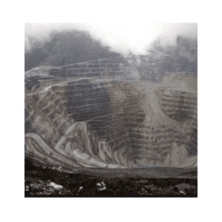
In this two-part activity, students will learn about the process of open pit mining using Google Earth and a 360 virtual mine tour.
They will work in student groups to identify and mark the footprints and boundaries of a mine using satellite imagery and learn how satellites give us valuable information about mines and the areas that surround them. Students will also learn how the practice of mining includes mitigation and reclamation plans. Student groups will research a large mining operation in the United States and create their own mitigation and reclamation plans for their mine.