Check out these activities to learn more about the airplanes, satellites and people who gather images and photos from high above the Earth and how the information is studied to better understand our world.
Jump to a Section:
What tools are used to gather information?
Scroll through this image carousel to learn more about the tools and aircraft used in the past and present.
Who works to gather information?
Meet Major Kris, a pilot of the U-2 aircraft (video)
Meet Colonel Buz Carpenter, former pilot of the SR-71 (video)
Jump to an Activity:
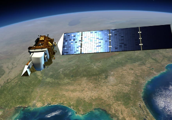
Because of technologies like Google Earth and agencies like NASA and NOAA (the National Oceanic and Atmospheric Administration) that release pictures from space, satellite images are now available to everyone from home– not just spies!
In this activity, explore your own neighborhood through Google Earth to discover what we can learn from satellite images. Use the steps below to analyze the image and the guiding questions to talk to each other about what you see.
Satellites take images of the Earth along the same path, over and over again. This is helpful for recording change over time.
Take a look at these images. Can you spot the differences? (Hint: You can click on the photo to make it larger.)
After you’ve looked at them closely, click on the + sign to check if you’ve spotted the differences and to learn about the changes you’re seeing in the images.