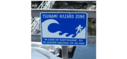
Tsunami is a Japanese word that means “harbor wave.”
It is a large wave caused by movements in Earth’s outer layer, or crust, which move ocean water. For example, an earthquake or a volcano in the ocean could cause a tsunami.
Earth’s crust is made up of pieces called tectonic plates. An earthquake happens when these plates push against each other so hard that one of them slips or breaks. Imagine leaning against a friend. If you push against each other harder and harder, one or both of you will fall over. When Earth’s plates push against each other, they can move a lot.
If an earthquake happens in the ocean, a large piece of Earth’s crust can be thrust upward or slip from side to side. The movement of a large chunk of Earth displaces the water above it, meaning it takes up the space where the water used to be. So where does the water go? It ripples out from the earthquake in waves.
This can also happen if a volcano erupts in the ocean. The lava flowing out of the volcano displaces the water around it. That water can turn into a large wave.
If the earthquake or volcano is very big, then the wave can be very big, too. Big tsunamis usually begin in the deep ocean, where a large volume of water can be displaced. As the wave moves closer to the shore, it grows taller as the ocean becomes shallower. If the water recedes—or moves away from the coast—after an earthquake, a big tsunami may be on its way.
Tsunamis can be hundreds of feet tall, and they travel very fast. This means they can be dangerous even for people who aren’t on the beach. Tsunamis can be extremely destructive and can knock down whole buildings.
But not all earthquakes or volcanic eruptions cause tsunamis. Whether a tsunami forms can depend on a lot of things. The shape of the ocean floor can determine if a tsunami happens. So can the distance and direction of the earthquake.
If there’s a chance a tsunami is on its way, you don’t want to be near the coast. So how can we tell if a tsunami is coming? We use satellites!
MISR (the Multi-angle Imaging SpectroRadiometer) is a NASA tool that watches for tsunamis from space. It has nine cameras, all pointed in slightly different directions. As the satellite passes overhead, it takes nine pictures of the same spot from different angles.
MISR can see sunlight reflecting off ripples and waves. Satellites that look straight down cannot see these ripples.
These images help scientists understand how tsunamis work. The more we learn about tsunamis, the better we can predict where, when and how strong a tsunami will be. That way, people can have enough warning to get away and stay safe.
Launched in 1998, NASA Space Place’s mission is to inspire and enrich upper-elementary-aged kids’ learning of space and Earth science online through fun games, hands-on activities, informative articles and engaging short videos.
With material in both English and Spanish and resources for parents and teachers, NASA Space Place has something for everyone.


