
This indicator describes global trends in sea surface temperature.
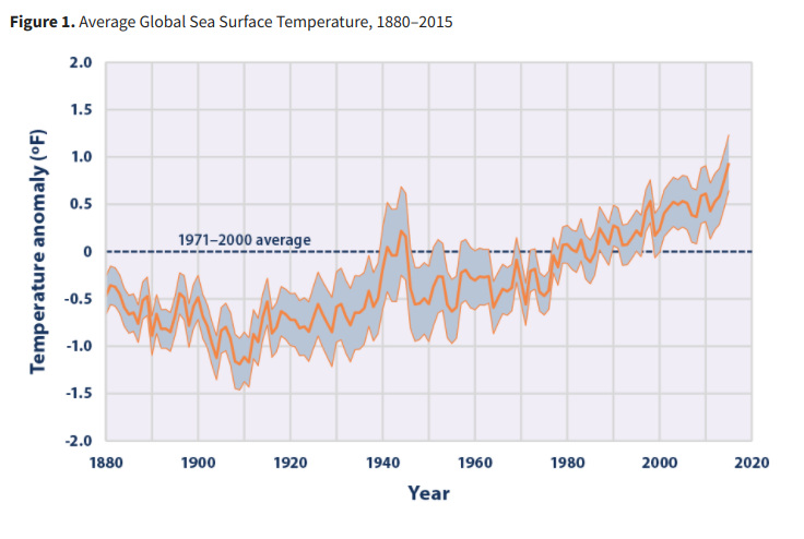
This indicator tracks average global sea surface temperature from 1880 through 2015. It also includes a map to show how change in sea surface temperature has varied across the world’s oceans since 1901.
Techniques for measuring sea surface temperature have evolved since the 1800s. For instance, the earliest data were collected by inserting a thermometer into a water sample collected by lowering a bucket from a ship. Today, temperature measurements are collected more systematically from ships, as well as at stationary and drifting buoys.
The National Oceanic and Atmospheric Administration has carefully reconstructed and filtered the data in Figure 1 to correct for biases in the different collection techniques and to minimize the effects of sampling changes over various locations and times. The data are shown as anomalies, or differences, compared with the average sea surface temperature from 1971 to 2000. The map in Figure 2 was developed by the Intergovernmental Panel on Climate Change, which calculated long-term trends based on a collection of published studies.
